
Land Portal
MarketingLand-specific data platform combining proprietary parcel records, MLS comps, and AI-assisted market analysis to accelerate acquisition decisions.
- State of the Art Mapping Features
- Nationwide MLS Data
- Comprehensive Data
Integrations Data exports to external tools (CRM, underwriting models, spreadsheets); direct mail and skip tracing; mobile app available
Overview
Land Portal is a land acquisition research and lead generation platform purpose-built for active land investors. It sits upstream of mail, skip tracing, and offers—the research layer that determines whether acquisition capital goes into a defensible market and whether pricing holds up in negotiation. The platform aggregates proprietary in-house parcel data with nationwide MLS records and county assessor information, then layers land-specific filters and mapping tools to help operators answer the questions that used to take weeks in an afternoon: which acreage bands in which counties are actually moving, at what price per acre, and with what velocity. Rather than treating land as residential records with blank fields, Land Portal's data model is built around the variables that drive land deals—acreage, access, road frontage, utilities, topography, ownership tenure, and out-of-state versus local ownership. The result is a research-first platform where wholesalers, fix-and-flip operators entering land, and BRRRR landlords sourcing raw parcels can validate market selection, run tight comparables in minutes instead of hours, and map due diligence before site visits.
How it works
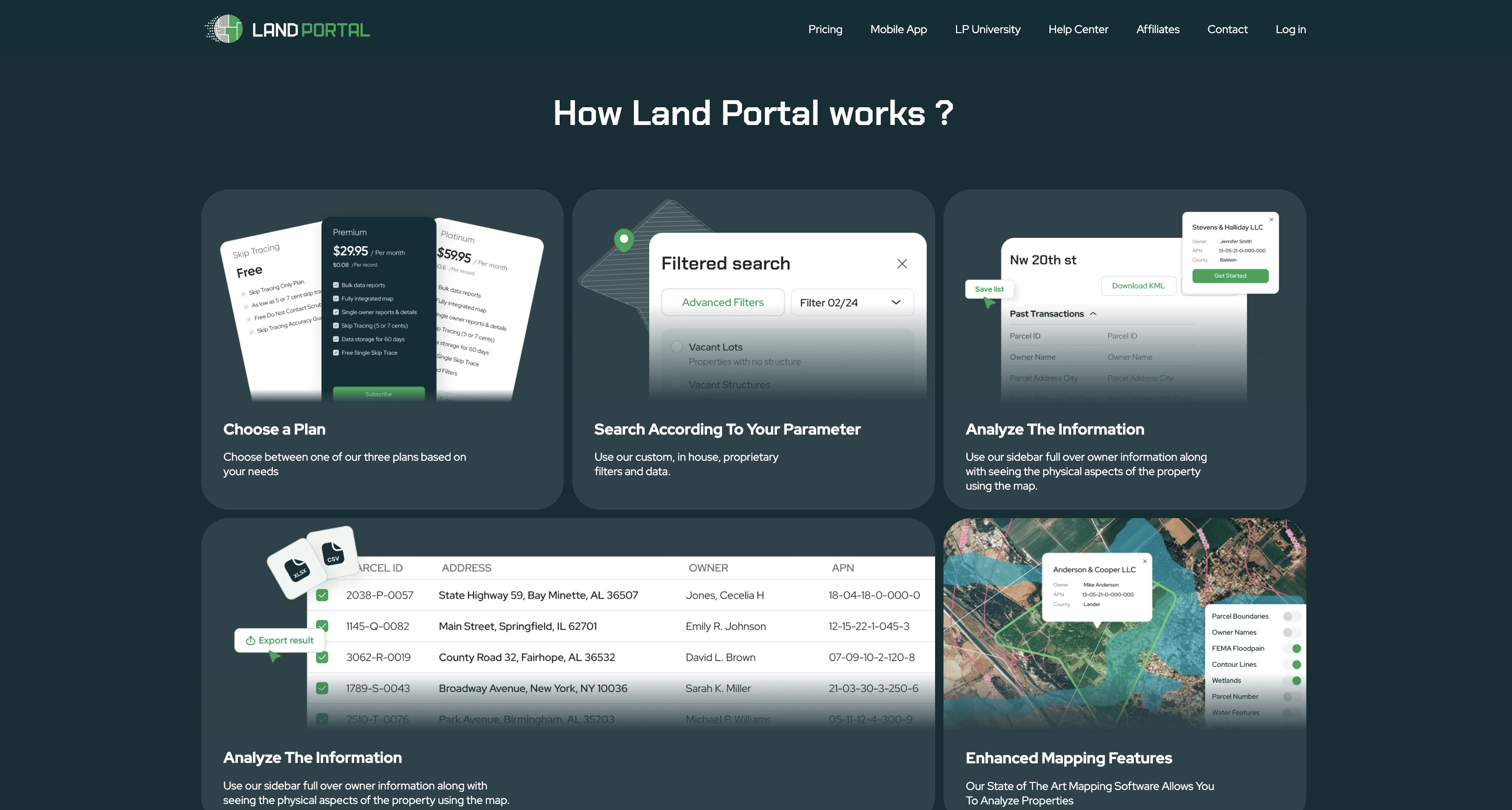
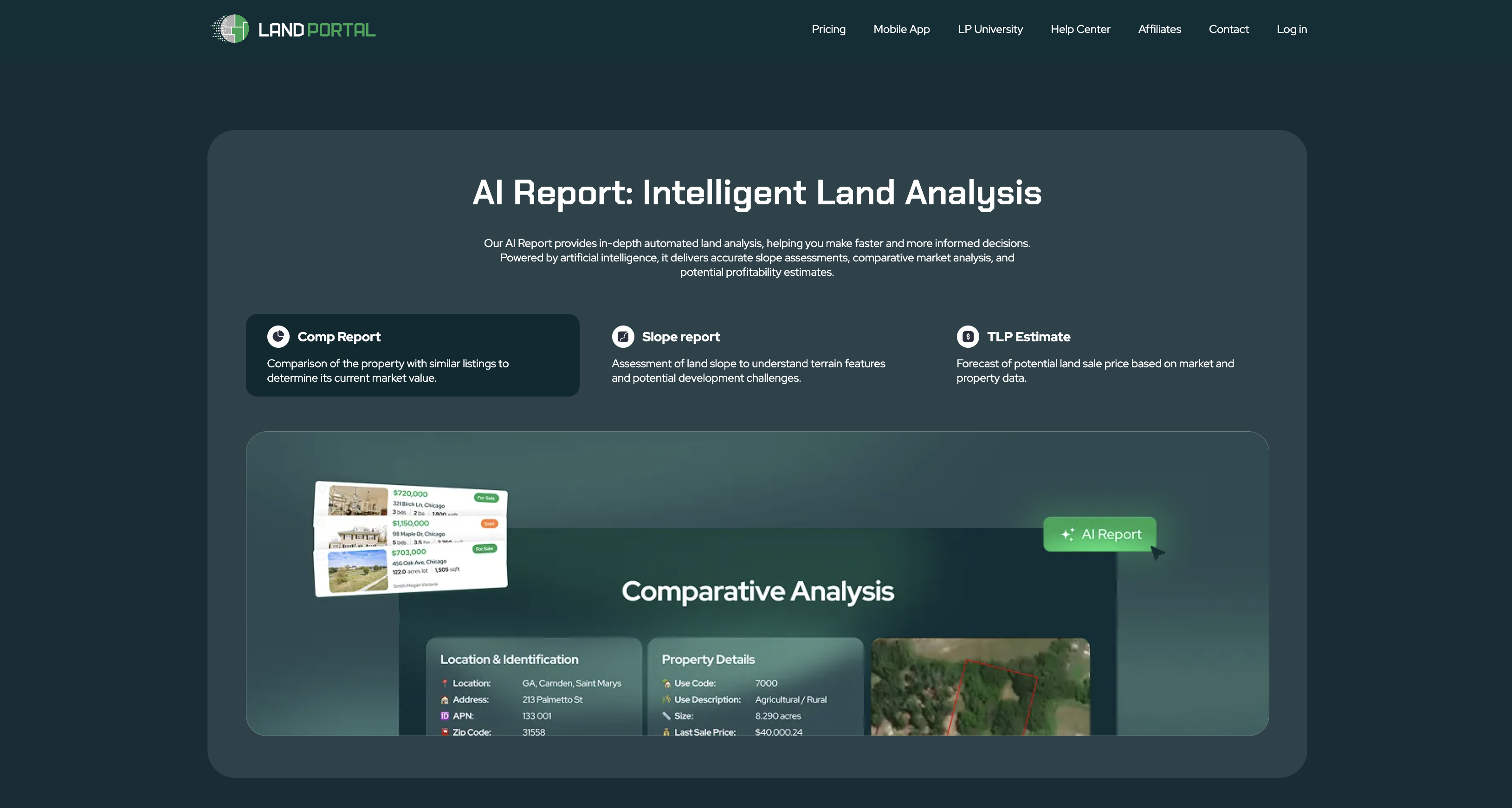
Operators start by selecting a subscription tier, then log into a dashboard centered around map-based research. The workflow begins with market selection: instead of filtering counties in the aggregate, the platform lets you filter to the acreage band you actually buy in—say, 5 to 20 acres—and then rank counties on metrics that matter: number of parcels sold in the last twelve months (not listings), days on market, median price per acre by band, price trend direction over 24 months, and out-of-state ownership percentage. This reframing moves the question from "is this a good market" to "is there a lane in this market where my capital and hold tolerance align." Once a market is selected, the platform's comping workflow pulls sold comparables around a subject parcel, constrains by acreage band and recency, and displays the distribution rather than a single number. This collapses the time from forty minutes to four, which means operators comp everything rather than cherry-picking, shifting discipline at scale. For due diligence, the integrated mapping suite overlays parcel boundaries, topography, aerial imagery, soil data, flood zones, wetlands, and access routes on the same screen as research and comps. Operators can measure, share maps with buyers, and catch issues—seasonal wetlands, impassable easements, or slope problems—before site visits. The platform updates daily and includes skip tracing to locate and contact property owners with phone and email, including free Do Not Contact scrubbing for compliance. The AI layer, called LP Intelligence, sits directly on top of the platform's market research and sales data. Rather than a generic chatbot, it answers questions in plain language grounded in the same dataset the comps pull from: "Which Arizona counties had the fastest sell-through on 5-to-20-acre parcels last year?" or "Show me markets with rising price per acre and inventory actually clearing." Follow-ups and refinements are instant, collapsing the analytical bottleneck from "hours of manual filtering per question" to "seconds per question," which shifts operator behavior toward deeper curiosity and better decisions. Data exports mean research doesn't dead-end in the dashboard. Filtered parcels, comps, and market analysis can be pushed to underwriting models, CRMs, or partner spreadsheets.
Best for
Land Portal is built for active land operators at scale: wholesalers who source raw land, fix-and-flip investors entering the land-to-development space, and BRRRR landlords seeking off-market or discount bulk parcels. It works best for operators past the "learning by losing money in bad counties" phase, or operators smart enough to skip that phase entirely. The platform's market research tier is most valuable for operators scaling acquisition across multiple counties and need to defend market selection with data rather than intuition or referrals. The comping discipline saves the most money for operators buying in the $2,000-to-$7,000-per-acre band where price per acre is nonlinear and off-market comps are hard to find. The due diligence mapping is essential for any operator who's been burned by title issues, wetlands surprises, or access problems discovered late. Skip tracing and mail fulfillment work for wholesalers and leaf-let operators, but the platform's real edge is in the research layer upstream of mail—operators who get market and pricing right send mail that works, rather than operators trying to mail their way out of a bad market selection.
Pricing reality
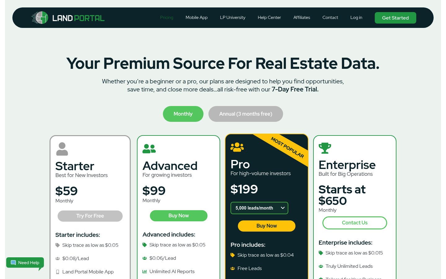
The website references three subscription tiers but does not display pricing on public-facing pages. A "Pricing" page exists at landportal.com/pricing but the content provided does not include the tier names, feature breakdowns, or dollar amounts. The FAQ mentions a free trial period may be available, with operators directed to "check our website or contact our sales team for the most up-to-date information on trial options." This suggests a demo or consultation-based sales motion for higher tiers. What is visible: the platform operates on a subscription model, operators can modify or cancel subscriptions at any time, and daily updates to property data are included (not a per-query or per-parcel charge). The sales messaging emphasizes affordability relative to competitor platforms like Land Insights, but without published pricing this claim cannot be verified. For accurate pricing, operators must initiate contact with the sales team or attempt a trial.
Combines nationwide MLS data with proprietary in-house land parcel records and land-specific filters (vacant lot detection at 99.8% accuracy, road frontage, wetlands, FEMA flood zones, slope analysis) that generic residential databases cannot provide. Includes conversational AI analysis grounded in the platform's own market research data rather than a general chatbot.
Pricing
Reviews across the web
✓ What operators praise
- Advanced GIS filters & interactive mapping tools tailored for land investors
- High-quality, accurate land data praised as best-in-class by users
- Affordable pricing with user-friendly interface boosting ROI
! Common concerns
- Mobile app bugs reported; support response times criticized
- No phone support available; limited direct customer service channels
Generated by REskout AI from public review content across the platforms above. Independent of our scoring rubric.
Customer testimonial
“I've pulled hundreds of thousands of pieces of data from numerous data providers, and The Land Portal is by far the best source for land data. Their continuous addition of new features will save me tens of thousands of dollars annually in marketing costs. — Landon B.”
Screenshots & documents
What operators say · 0 reviews
No reviews yet. Be the first operator to review Land Portal.
✎ Write the first review